
Bethlehem Live Weather Camera sponsored by St. Luke's University Health Network
-
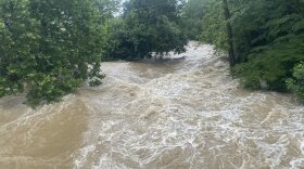
 The heavy rains wreaked havoc on the region, already saturated by a round of storms last weekend. And more rain is expected this week.
 -
With the strong possibility of more smoke this summer, the Valley's residents and event organizers are looking to the region’s leaders for guidance — but there’s no continuity or clear thresholds being imposed.
-
How much rain fell in the Lehigh Valley on Sunday, turning streets into raging torrents of water?
-
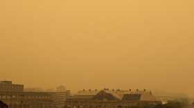
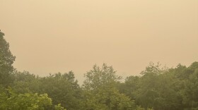
Smoke from the Canadian wildfires has been transported south and east and is moving into Pennsylvania.
-
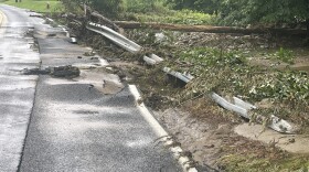
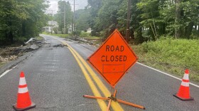
Messinger and South Main streets in Bangor turned into a waterway after downpours hit early Sunday. Said one resident: “By the grace of God we didn’t lose power and everyone is OK. That is the most important thing."
-
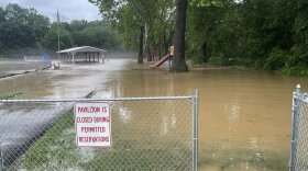
The entire Lehigh Valley will remain under a flood watch through Sunday after another round of severe storms hammered the region. Tonight's Heritage Day fireworks show in Easton is postponed again, the city announced. Bushkill Park in Forks Township and parts of the Slate Belt were flooded.
-
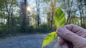
The disease, a relatively new and deadly threat to the American beech, has few treatment options and no known cure.
-
Astronaut John Shoffner stopped by Crayola Experience in Easton on Friday, July 14 to discuss his voyage to the International Space Station and answer kids' questions about the cosmos.
-
-
The Lehigh Valley has measured 7.47 inches of rain since June 1. Almost half of it has come this month, and we'll add on to that number in the coming days.


-
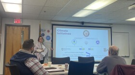
Officials on Wednesday reviewed several preliminary transportation policy strategies for the Valley's priority climate action plan. The plan’s focus is to reduce carbon emissions from transportation, a significant driver of greenhouse gas emissions across the region.
-
More than three dozen projects in the Valley were awarded grants, receiving about 7% of the total funding awarded. Statewide, $335 million in grants were announced Wednesday.
-
"Turn around, don't drown", warned a spokesperson for PennDOT. More than once today, people in the Valley have had to be rescued from their cars after driving into water that shut their engines off, trapping the drivers.
-
Some parts of the Lehigh Valley saw more than four inches of rain from Sunday into Monday, with precipitation still falling.
-
Schools are closing early and a large swath of the region is under a flood warning until at least 3:15 p.m. as the storm system that inundated the area overnight moves north.
-
The winter, or December, solstice takes place this year between sundown on Dec. 21 and sunrise Dec. 22
-
The Lehigh Valley Planning Commission at 11 a.m. on Wednesday is holding a meeting at its Allentown office to brainstorm and prioritize ways to decarbonize transportation across the region. Decarbonization is the process of reducing or eliminating carbon dioxide emissions.
-
Many spots could receive 2 to 3 inches of rain, forecasters warn, with areas of flooding possible Sunday night as another coastal storm targets the region.
-
Amid the joy and festivities, environmental advocates are urging residents to keep sustainability in mind during what can be a time of year when trash and waste spikes.
-
State environmental officials on Thursday evening hosted the last of five public engagement sessions, as they work to create a Priority Climate Action Plan, or PCAP, aiming to reduce greenhouse gas emission statewide and mitigate further effects of climate change.
-
Forecasters say another impactful storm is expected to move up the coast, bringing heavy rain and gusty winds to the region Sunday into Monday.
-
The new official map marks recently acquired land, while setting priorities for future desired open space.