
Bethlehem Live Weather Camera sponsored by St. Luke's University Health Network
-
 The National Weather Service rated the tornado as an EF-1 — the second-weakest on the scale. It hit the Midway Manor neighborhood of Allentown and crossed into Bethlehem briefly, according to a weather service statement.
 -
A National Weather Service survey team confirmed a tornado touched down in Allentown’s Midway Manor neighborhood Monday night on the east side, but the twister was unwarned.
-
Starting at 9 a.m., officials from Princeton Hydro, a New Jersey-based engineering consultant, will treat the lake’s shoreline via airboat to tamp down invasive Phragmites, a genus of four species of large perennial reed grasses.
-
The ordinance adjustments approved Monday night would align the township with the state model for stormwater management guidance.
-
Neighbors in the Midway Manor neighborhood of Allentown reported seeing a twister as the storm tore through the city's East Side on Monday night. There were no reports of serious injuries, but property damage was extensive.
-
A severe storm knocked out power to thousands in Lehigh County and sent Musikfest revelers searching for cover Monday night. As of 6 a.m. Tuesday, 16,000 customers have lost power.
-
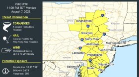
The National Weather Service has issued a tornado watch for the Lehigh Valley and much of the Mid-Atlantic region.
-
WLVR’s Brad Klein speaks with Environment & Science Reporter, Molly Bilinski about the start later this month of the annual Bake Oven Knob Hawk Watch.
-
Take a look at stories that ran throughout the week of which we are most proud, had a profound impact on readers or that you might want to look at again.
-
This Sunday, Nestor Gil will premier his new work, LaJiraGira, at the Karl Stirner Arts Trail. The piece focuses on how simple concepts can be interpreted through the lens of art.






-
“This is not just a one-day spike,” the weather service said in its forecast discussion. “Very warm and above normal temperatures will continue through the upcoming weekend.”
-
Officials and executives at the Lehigh Valley Economic Development Corporation's annual meeting Tuesday pulled back the curtains on Eli Lilly's decision to open in the region.
-
The winter storm that prompted dire forecasts and a statewide disaster declaration largely fizzled in the Lehigh Valley, leaving the area with only moderate to light snowfall by Monday morning.
-
As the Lehigh Valley’s most recent blanket of snow rapidly melts away, Mother Nature appears ready to test the region’s patience all over again.
-
The early LIHEAP crisis numbers already represent a notable share of last winter’s total in the Lehigh Valley, according to data provided by the Department of Human Services.
-
An extreme cold warning, combined with a wind advisory also in effect, could mean wind chills as low as 20 degrees below zero for the region this weekend.
-
A webinar Monday brought together regional planners, engineers and industry leaders to explain how data centers operate and what their growth could mean for local communities.
-
Powering up on protein: As focus zeroes in on nutrition, here's how to navigate the nutritional mazeProtein is king in the world of nutrition at the moment, but there are plenty of questions surrounding the trend. Let's take a look at what it is, where to get it from, and how to navigate the complex world of nutrition.
-
Month-to-date snowfall in the Allentown area now stands at 20.8 inches, nearly triple the normal January average of 7.7 inches, according to the National Weather Service.
-
The storm dropped a record 11.8 inches of snow on Lehigh Valley International Airport, breaking the old record of 10.4 inches for the date set in 1988.
-
Forecasters say the Lehigh Valley region could see 10 to 16 inches of snow and sleet accumulations, with a wintry mix of snow and sleet expected Sunday afternoon and evening. A winter storm warning remains in effect into Monday afternoon.
-
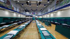
Lehigh Valley shelters are adding capacity as meteorologists forecast between 10 and 16 inches of snow starting Sunday.