

Bethlehem Live Weather Camera sponsored by St. Luke's University Health Network
-
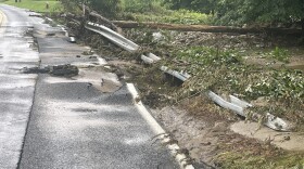
 The heavy rains wreaked havoc on the region, already saturated by a round of storms last weekend. And more rain is expected this week.
 -
With the strong possibility of more smoke this summer, the Valley's residents and event organizers are looking to the region’s leaders for guidance — but there’s no continuity or clear thresholds being imposed.
-
How much rain fell in the Lehigh Valley on Sunday, turning streets into raging torrents of water?
-
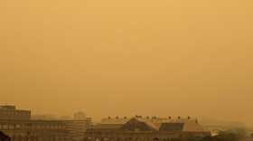
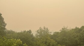
Smoke from the Canadian wildfires has been transported south and east and is moving into Pennsylvania.
-
Messinger and South Main streets in Bangor turned into a waterway after downpours hit early Sunday. Said one resident: “By the grace of God we didn’t lose power and everyone is OK. That is the most important thing."
-
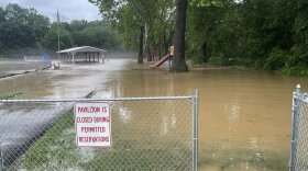
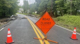
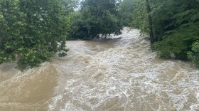
The entire Lehigh Valley will remain under a flood watch through Sunday after another round of severe storms hammered the region. Tonight's Heritage Day fireworks show in Easton is postponed again, the city announced. Bushkill Park in Forks Township and parts of the Slate Belt were flooded.
-
The disease, a relatively new and deadly threat to the American beech, has few treatment options and no known cure.
-
Astronaut John Shoffner stopped by Crayola Experience in Easton on Friday, July 14 to discuss his voyage to the International Space Station and answer kids' questions about the cosmos.
-
-
The Lehigh Valley has measured 7.47 inches of rain since June 1. Almost half of it has come this month, and we'll add on to that number in the coming days.



-
“This is not just a one-day spike,” the weather service said in its forecast discussion. “Very warm and above normal temperatures will continue through the upcoming weekend.”
-
Officials and executives at the Lehigh Valley Economic Development Corporation's annual meeting Tuesday pulled back the curtains on Eli Lilly's decision to open in the region.
-
The winter storm that prompted dire forecasts and a statewide disaster declaration largely fizzled in the Lehigh Valley, leaving the area with only moderate to light snowfall by Monday morning.
-
As the Lehigh Valley’s most recent blanket of snow rapidly melts away, Mother Nature appears ready to test the region’s patience all over again.
-
The early LIHEAP crisis numbers already represent a notable share of last winter’s total in the Lehigh Valley, according to data provided by the Department of Human Services.
-
An extreme cold warning, combined with a wind advisory also in effect, could mean wind chills as low as 20 degrees below zero for the region this weekend.
-
A webinar Monday brought together regional planners, engineers and industry leaders to explain how data centers operate and what their growth could mean for local communities.
-
Powering up on protein: As focus zeroes in on nutrition, here's how to navigate the nutritional mazeProtein is king in the world of nutrition at the moment, but there are plenty of questions surrounding the trend. Let's take a look at what it is, where to get it from, and how to navigate the complex world of nutrition.
-
Month-to-date snowfall in the Allentown area now stands at 20.8 inches, nearly triple the normal January average of 7.7 inches, according to the National Weather Service.
-
The storm dropped a record 11.8 inches of snow on Lehigh Valley International Airport, breaking the old record of 10.4 inches for the date set in 1988.
-
Forecasters say the Lehigh Valley region could see 10 to 16 inches of snow and sleet accumulations, with a wintry mix of snow and sleet expected Sunday afternoon and evening. A winter storm warning remains in effect into Monday afternoon.
-
Lehigh Valley shelters are adding capacity as meteorologists forecast between 10 and 16 inches of snow starting Sunday.